Course description
Introduction
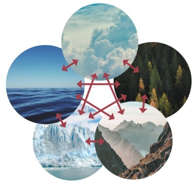
Our planet Earth may be viewed as a complex environmental system consisting of different interacting sub-systems or components. Here, a steady influx of solar radiation provides the heat and light energy needed to support life in the biosphere. This chapter characterizes the basic structures of these life support (bio-physical) sub-systems i.e. atmosphere, hydrosphere, lithosphere and biosphere including an overview of their functions and inter-connectedness. The lithosphere is the upper mantle of rock and crust that forms the tectonic plates upon which the continents lie. The hydrosphere is the body of water- a remarkable substance, present as ice, liquid water or water vapour, which covers approximately three-fourths of the earth’s surface. Because of its unique characteristics, it stabilizes the biosphere’s temperature and provides the medium in which life processes occur. The earth’s atmosphere is the gaseous shell outside these two non-living components that provides gases necessary for life, helps maintain surface temperatures, and filters out dangerous radiation. The biosphere is formed by the regions (biomes) of living organisms that have established themselves in the other three spheres. The biomes are characterized by similar climates, soil and biological communities- plants, animals and microbes.
Basic Components of the Natural Environment
A: Atmosphere (the air)
The atmosphere consists of a mixture of several life-sustaining gases known as the air. In fact, we live at the bottom of a virtual ocean of air that is held to the earth by gravitational attraction. It envelops the earth, extending as far as 1600 km above the surface. It forms a protective shell over the Earth. It is like a blanket covering the earth, and acts as insulation retaining the warmth of the sun that reaches the earth. Atmosphere provides oxygen that plants and animals need to stay alive. It is a source of carbon dioxide that green plants need for photosynthesis. The atmosphere also acts as a shield protecting the earth from cosmic rays and filters out the tissue damaging ultraviolet radiation of the sun. Thus, without the atmosphere life would not be possible on earth. Living creatures cannot survive without air even for a few minutes. To continue to support life, the air must be kept clean.
Composition and Nature
Air is neither an element nor a compound; it is a complex mixture of several gases, and its composition remains fairly uniform in lower layers of the atmosphere. Composition of air, though, has changed over a period of time with the age of the Earth it can be considered stable and conducive to life in the present era. The two chief gases of air are: Nitrogen (78 percent) and oxygen (21 percent, by volume of pure dry air). The remaining slightly less than 1 percent of other gases is composed of argon (Ar, 0.093 percent), carbon di oxide (CO2, 0.033 percent) and the trace amount of neon (Ne), helium (He), methane (CH4), krypton (Kr), hydrogen (H2), Xenon (Xe), Ozone (O3) (Table 2.1) and chlorofluorocarbons (or CFCs, put there by human activities). Nitrogen is basic for all organic processes and for making fertilizers. Nitrogen in the atmosphere exists as a molecule consisting of two nitrogen atoms (N2) and does not enter easily into chemical union with other substances and can be thought of mainly as a neutral substance. Very small amounts of N2 are extracted by soil bacteria, and are made available for use by plants. In contrast to N2, oxygen gas (O2) is highly reactive chemically. It combines readily with other elements in the process of oxidation. Combustion of fuels represents a rapid form of oxidation process, whereas certain forms of rock decay (weathering) represent very slow form oxidation. Oxygen is important for breathing of living beings, and for combustion. Living tissues require oxygen to convert foods into energy. Argon is an inactive gas of little importance in natural processes. In addition there is a very small amount of carbon di oxide (CO2) that absorbs both incoming shortwave solar radiation and outgoing longwave radiation, keeping the lower layers warm. Absorption of longwave solar radiation is particularly important for the greenhouse effect. Carbon dioxide is used by green plants in the photosynthesis process, during which CO2 is converted into chemical compounds that build up the plant's tissues, organs, and supporting structures. Another important component of the atmosphere is water vapour- the gaseous form of water which can vary in concentration. Usually, water vapour makes up less than 1 percent of the atmosphere. Under very warm and moist conditions, as much as 2-5 percent of the air can be filled with water vapour (amounts varying from 0.01 percent by volume at the frigid poles to 5 percent in the humid tropics) which causes the formation of clouds and precipitation e.g. rainfall and snowfall. Since water vapour is a good absorber of solar radiation, it plays a major role in warming the lower atmosphere. The atmosphere also contains dust and tiny floating particles that absorb and scatter radiation. Solid particles of inorganic origin constitute other substances suspended in the air i.e. dust, ash, smoke etc. Solid particles of organic nature are pollen and various kinds of bacteria. The solid particles act as nuclei for change of water vapour into raindrops around them. They also scatter solar radiation during sunrise and sunset.
Table 2.1: Composition of the Earth’s Atmosphere
Gas Relative Percentage
Nitrogen 78.08
Oxygen 20.95
Argon 00.93
Carbon dioxide 00.033
Neon 00.0018
Helium 00.00052
Methane 00.00015
Krypton 00.0001
Hydrogen 00.00005
Nitrous oxide 00.00005
Xenon 00.00009
Ozone 00.00007
Source: Asthana, 2001
Vertical Structure
The atmosphere is not infinite but extends up to certain height above the surface of the earth. Atmospheric scientists divide the atmosphere into several spherical layers called troposphere, stratosphere, mesosphere and thermosphere, characterized by abrupt changes in temperature due to differences in the absorption of incoming solar radiation (Figure-2.1). Understanding how these layers differ from each other and what creates them help us comprehend our knowledge of atmospheric functions. It is the pull of Earth’s gravity that holds the atmosphere in place; since the pull is strongest near the Earth’s surface, air has a higher density (mass per unit volume) near Earth’ surface than at higher altitude.
Troposphere: The stratum of air nearest to Earth’s surface is called the troposphere. It is the densest layer; about 75 percent of the mass of earth’s air is found in this innermost layer, extending only about 17 km above sea level at the equator, and above 8 km over the poles. The troposphere’s composition is relatively uniform over the entire planet because this layer is strongly stirred by winds. It is a turbulent, dusty zone containing much water vapour, clouds, rain and snow. Climatic conditions affecting the earth such as lightening, thunderstorms, and cyclones occur within this zone. Air temperature drops rapidly with increasing altitude (6 degree Celsius for every km gain) in this layer- called adiabatic lapse rate. A sudden reversal of this temperature gradient creates a sharp boundary- the tropopause- that limits mixing of air between the troposphere and the upper zone. The tropopause lies about 10 km over the poles and abot 15 km over the equator.
Stratosphere: The next atmospheric layer lying above the troposphere is the Stratosphere. It extends from the tropopause to about 60 km above the earth’s surface. Within the stratosphere, the temperature is almost constant in the vertical direction in its lower layers, but starts increasing at higher levels. Because of the very low temperature, there are virtually no water vapour, dust or clouds.. Air in this zone is calm; there is no convection current or vertical mixing. Pilots like to fly in this layer because it has so little turbulence. The stratosphere is rich in ozone, which absorbs harmful ultraviolet radiation from the Sun. This “global sunscreen” also prevents damage to some plants, aquatic organisms, and other animals. The top of the stratosphere is called stratopause- an imaginary line that separates the Sratosphere from the next layer.
Mesosphere: Above the stratopause, the temperature diminishes again creating the Mesosphere or middle layer, which extends up to 80 km. Temperatures in this layer decrease with altitude. The top of the mesosphere is called mesopause.
Thermosphere: At an altitude of 80 km, another abrupt temperature change occurs. This is the beginning of the Thermosphere- a region of highly ionized gases, extending out to about 1600 km. Temperatures are very high in this layer because molecules there are constantly bombarded by high-energy solar and cosmic radiation. The atmospheric layer lying beyond the mesosphere, but obviously the lower part of the thermosphere is called the Inosphere. It extends up to the height of about 400 km. The inosphere contains electrically charged particles called “ions”. These particles reflect radio waves back to the earth surface and enable us to have wireless/ radio communication.
Figure- 2.1: Vertical Structure and Temperature of the Atmosphere
Exosphere: The uppermost layer of the atmosphere is called the Exosphere. It extends from a height of 1,600 km and gives way to the outer space. Very little is known about its structure and composition.
Insolation and Temperature
The earth's surface receives nearly all it heat energy from the sun called insolation. As the shortwave radiation penetrates the atmosphere, its energy is absorbed or diverted in various ways. For example, the outer layer of the atmosphere absorbs gamma and x rays. Ozone absorbs much of the harmful ultraviolet radiation at stratospheric level. As radiation moves through deeper and denser atmospheric layers, gas molecules, dust and other particles cause some radiation to be scattered (moving in all directions) known as diffuse radiation. In the process, some energy is sent back into outer space in the form of diffuse reflection (3 percent under clear sky conditions), and some flows down to the earth's surface. Among heat absorbers, carbon dioxide and water vapour are the two prominent gases. Absorption results in a rise in air temperature at the lower level, accounting for about 17 percent of the incoming solar radiation. Thus, under clear skies, diffuse reflection and absorption together total 20 percent, leaving as much as 80 percent of the solar radiation to reach the ground. However, the presence of cloud can greatly increase the amount of diffuse reflection. Cloud reflection (back to space) can account from 30 to 60 percent of incoming solar radiation. Clouds also absorb radiation, perhaps from 5 to as much as 20 percent. Under the conditions of a heavy cloud cover as little as 10 percent of solar heat may reach the ground.
Temperature Inversion: Air temperatures seem to decrease with altitude above the earth's surface, particularly in the troposphere. But this is not always true. Under calm and clear night conditions, the ground surface radiates degraded long wave energy to the sky, net radiations becomes negative and the surface cools down, indicating that the air immediate to the surface will also be cooled. If the surface continues to stay cold, a layer of cooler air is likely to accumulate underneath a layer of warmer air. As we move up from ground level, surface temperatures become warmer up to about 300m (1000 ft). This is the point where the curve reverses itself, and normal lapse rate takes over. The lower portion of the normal lapse rate curve is called a low-level temperature inversion. Here, the normal cooling trend of the curve is reversed and temperatures increase with altitude. Low-level temperature inversions usually occur over snow-covered surfaces in winter. They build up over many long nights in arctic regions, where the solar heat of the short winter day cannot completely compensate for nighttime cooling.
Fog
Fog is simply a cloud layer very close to the earth surface- is a major environmental hazard in the industrial world. Dense fog on high-speed highways can cause chain-reaction accidents. At airports, landing delays and shutdowns occur because of fog bearing economic losses to airlines, causing inconveniences to thousands of travelers in a single day. In addition, pollution fogs in big cities like those of London can injure urban dwellers' lungs and take a heavy toll in life. One type of fog, known as radiation fog, is formed at night when the temperature of air layer at the ground level falls below the dew point. This kind of fog is associated with low-level temperature inversion. Another fog type, advection fog, results when a warm, moist air layer moves over a cold surface.
Clouds
Clouds are common features of the atmosphere, is made up of water droplets or ice particles suspended in the air. These particles have a diameter in the range of 20 to 50 mm (0.0008 to 0.002 in). Each cloud particle is formed on a tiny center of solid matter, called condensation nucleus, which has a diameter in the range 0.1 to 1 mm (0.000004 to 0.00004 in). An important source of condensation nuclei is the heavy load of dust carried by polluted air over cities, giving rise to the formation of clouds and fog. Clouds consist entirely of water droplets at temperatures well down to about -12 Degree C (10 Degree F). As cloud temperatures decrease further, a mix of water droplets and ice crystals occurs.
Precipitation
Clouds are the main source of precipitation- the process that provides the fresh water essential for all forms of terrestrial life. Precipitation from clouds occurs as rain, hail, snow and sleet. These can form in two ways: i) In warm clouds, fine water droplets condense, collide, and coalesce into larger and larger particles that can fall on earth's surface as rain.; ii) in colder clouds, ice crystals usually form and grow in a cloud that contains a mixture of both ice crystals and water droplets. The first process occurs when saturated air rises rapidly, and cooling down operation forces additional condensation. Cloud droplets increase by added condensation and attain initially a diameter of 50 to 100 mm (0.002 to 0.004 in). However, in collisions with one another, the droplets grow in size to about 500 mm in diameter (about 0.02 in). This is the size of water droplets in most drizzle. Further collisions and coalescence increase drop size and yield rain. Average raindrops have diameters of about 1000 to 2000 mm (about 0.04 to 0.1 in), but they can reach a maximum value of about 7000 mm (about 0.25 in). Beyond this value, they become unstable and break into smaller drops while falling- a typical of rain formation in the equatorial and tropical zones. Snow is produced by the second process in cold clouds that are a mixture of ice crystals and cold water droplets. When the underlying air layer is below freezing, snow reaches the earth's surface as a solid from of precipitation. Otherwise, it melts and arrives as rain. A reverse process, the fall of raindrops through a clod air layer, results in the freezing of rain and produces grains of ice (known in North America as sleet). Hail is another form of precipitation, consists of lumps of ice ranging from pea to grapefruit size with a diameter of 5mm (0.2 in) or larger. There are three types of precipitation on the basis of processes- orographic, convectional and cyclonic. In orographic precipitation, air moves up and over a mountain barrier. As it moves up, it cooled down adiabatically and forms rain. In convectional precipitation, unequal heating of the earth's surface causes an air parcel to warmer and lighter than the surrounding air, and it rises. As it moves upward, it cools and condensation eventually leads to precipitation. Under conditions of unstable air, thunderstorms can form, yielding hail and lightening.
B: Hydrosphere (the water)
Distribution
Hydrosphere may be equated with the total water storage capacity of the globe, which consists of Earth’s liquid water (both surface- inland water bodies, and underground), ice (polar ice, ice bergs, ice in permafrost), and water vapour in the atmosphere. The oceans and seas cover 71 percent of the earth’s surface; no wonder our Earth may be called the water planet. The distribution of water in this planet may be better described in terms of interacting compartments. Together, the oceans contain approximately 97 percent of all liquid water in the world, but they are generally too salty for most human uses. Of the remaining 3 percent of all water that is available to us as fresh, about 2.997 percent of it is locked up in glaciers, ice caps, or snowfields. Only about 0.003 percent of planet’s total volume of water is easily available to us as soil moisture, exploitable groundwater, water vapor, lakes and ponds, rivers and streams (Table 2.2), and wetlands (bogs, swamps and marshes). When wetlands are disturbed, their natural water-absorbing capacity is reduced. This has a disastrous effect on biological diversity and productivity, as well as on human affairs. The atmosphere is among the smallest of the major water compartments of the earth in terms of water volume, containing 0.001 percent of the total water supply.
Table 2.2: Earth’s Water Compartment
Compartment % Total Water
Ocean 97.6
Ice and snow 2.07
Groundwater 0.28
Freshwater Lakes and reservoirs 0.009
Salt lakes 0.007
Soil moisture 0.005
Moisture in plants and animals 0.005
Swamps and marshes 0.003
Atmosphere 0.001
Rivers and streams 0.0001
Total 100.00
Source: Adapted through modification from Cunningham, 1997.
As a basic natural resource, water is vital for our very existence, and is absolutely essential for all forms of life on Earth. It is truly a marvelous substance that dissolves nutrients, distributes them to body cells, regulates body temperature, supports body structures and removes waste products. The current forms of life containing cells and tissues is consists mostly of water; in the human population, men are about 60 percent water by weight, most animals are about 65 percent water, and a tree is about 60 percent water by weight. It is the availability of water that determines the nature, composition and abundance of terrestrial life. Regions with very low rainfall become desert, where lush green vegetation develops due to water abundance. It is the very medium in which all bio-chemical reactions within organisms and between the abotic environment occurs, and plays an important role in reducing the atmospheric burden of particulates and gaseous pollutants. According to an estimate, if the world’s water supply were only 100 liters, our usable supply of fresh water would be only about 0.0003 liter or one-half teaspoon- only a tiny fraction of the planet’s abundant water.
Renewal- The Hydrologic Cycle
Fortunately, the available fresh water amounts to a generous supply that is constantly moving in the water cycle. Water evaporates from water bodies, and also from the soil. Plants also give off water through transpiration. As water reaches high altitudes it condenses and eventually comes back to earth in the form of rain. Some of these percolate through the soil into underground aquifers but most of it reach the rivers, lakes and seas/ oceans as surface runoff. Thus, in the natural state, recycling provides us with a supply of purified water that is vital for life. This natural recycling and purification process provides plenty of fresh water to the landmasses, while also playing a crucial role in creating a habitable climate by moderating world temperatures. As mentioned above, the hydrologic cycle collects, purifies, and distributes Earth’s fixed supply of water. The cycle consists of 7 prominent and continuous events, describing the circulation of Earth’s fixed supply of water (Figure- 2.2). The main processes are: (i) Evaporation (conversion of liquid water into water vapor); (ii) transpiration (evaporation from leaves of water extracted from soil by plant roots); (iii) condensation (conversion of water vapor into droplets of liquid water); (iv) precipitation (rain, hail, snow, sleet etc); (v) infiltration (movement of water into soil in the form of gravitational flow); (vi) percolation (downward flow of water through soil and permeable rock to aquifers), and (vii) runoff (downward surface movement of water back to sea to begin the cycle again). The process may last as long as we don’t either overload it through degradation or withdraw it from underground supplies faster than it is replenished. Unfortunately, we are doing both. Even differences in annual mean precipitation divide the world into water “haves” and have-nots”; rainfall occurs unevenly across the geographic space.
Figure- 2.2: The Hydrologic Cycle Source: Google images
Global Water Supply Budget
The main driving force of the hydrologic cycle is the Sun, powered by solar radiation and the gravity. Incoming solar energy evaporates water from oceans, streams, lakes, soil, and vegetation. Each year, the sun evaporates approximately 496,000 km3 of water from the earth’s surface (more evaporates over the oceans than over land, and more evaporates in the tropics than at higher latitudes and altitudes). Although the oceans cover about 71 percent of the earth’s surface, they account for about 86 percent of total evaporation, the rest comes from land. However, the global water supply budge is counter balanced by global circulation systems- on land, in the atmosphere, and in the ocean- that move water from areas of surplus to areas of deficit. Rivers that carry water from the land to the sea are automatically balanced by prevailing wind currents (moving rain-bearing air from one place to another). Equally important is ocean currents that carry warm water from the equator to higher latitudes on the surface of the earth. Plants also play an important role in the hydrologic cycle by absorbing ground water and pumping it into the atmosphere by transpiration (transport plus evaporation). In tropical rain forests, as much as 75 percent of annual precipitation is returned to the atmosphere by plants. According to an estimate, about 90 percent of the water evaporated from the ocean comes back to the ocean as rain. The remaining 10 percent is carried out by prevailing winds over the continents. Combining it with water evaporated from soil, plant, lakes, streams, and wetlands, provides a total continental precipitation of about 111,000 km3. Some of this is incorporated by plants and animals, particularly in biological tissues. A lion share of what falls on land percolate into the ground to be stored as soil moisture or ground water. About 40,000 km3 of rain water is carried back to the ocean each year by surface runoff. Precipitation that does not soak into the ground or return to the atmosphere by evaporation or transpiration is called surface water. It forms streams, lakes, wetlands and artificial reservoirs. The areas of land that drain into bodies of surface water are called watersheds (also known as drainage basins). Water flowing off the land into these bodies is called surface runoff. However, human interference such as construction of barrage and dams intercept the natural surface runoff, creating artificial water bodies where there was natural vegetation (e.g. Kapti Lake in Bangladesh). Embankments along riverbanks also interrupt the natural flow of water. Destruction of forests and vegetation cover disrupts the natural process of percolation and increase the volume of surface runoff. Reduction in percolation decreases the rate of research of underground aquifers. There is excessive abstraction of groundwater for drinking and irrigation purposes leading to its depletion. Pollutants are being added to different types of water bodies from various sources. Some types of atmospheric pollutants give rise to acid rain.
Ground Water
In the hydrologic cycle, some precipitation infiltrates the ground and fills the pores in soil and rock. The subsurface area of the earth where all the available soil and rock spaces are filled by water is called the zone of saturation, and the water in these pores is called ground water. The underground sources of freshwater are aquifers. These are natural underground reservoirs of fresh water with porous, water-saturated layers of sand, gravel and rock through which ground water flows. Aquifers underlain by impermeable layers of rock and clay that keeps water from seeping out at the bottom. Most aquifers are replenished naturally by precipitation that percolates downward through soil and rock – a process called natural research. These may consist of free flowing water as in a river or these may be water filling spaces between gravel and sand particles; may be huge in size spreading over hundred of miles; may occur at different depths- may be shallow or deep; may take thousands of years to fill by gradual percolation of water from rainfall through rivers and streams, layers of soil and sand. Nearly half of the total volume of groundwater resource (4,200 thousands of cubic km) is within 0.8 km of the earth’s surface, the other half lies in between 0.8 km and 4.0 km depth. The stratum through which water percolates has both air-filled and water-filled spaces and is known as the zone of aeration. The stratum further down has spaces between rocks filled only with water. This is called the zone of saturation. The water table is the top most surface of the zone of saturation; it is neither flat (undulates according to the topography and subsurface structure of the area) nor stationary through the seasons- rising and falling according to precipitation and infiltration rates; it falls in dry season and rises in wet (monsoon) season. Since aquifers are researched through infiltration of rainwater, any area of earth surface in which infiltration of water into an aquifer occurs is called a research zone. There is 40 times as much ground water as there is surface water, but only a small amount of it is economically exploitable. Water drawn from aquifers, in general is of better quality than surface water. As water filters through layers of soil, it has low bacterial content and has excellent clarity. Depending on the geological structure of the area and the depth from which it is drawn, the salinity and mineral content of the water may vary. Water at greater depth is of high mineral content. If water table is depleted, the water drawn from such aquifers may also contain higher levels of minerals. Groundwater nearer the surface in the coastal regions will have higher level of salinity. Likewise, groundwater occurring in volcanic rock formations may also have higher levels of minerals. When water is abstracted from an aquifer by drilling a well, a conical depression of water table is formed around the well. This is known as the cone o depression. As more and more water is abstracted, the cone deepens. Eventually the cone o depression may reach to the very bottom of the well. When this happens, the well runs dry. If the water extracted from the aquifer surpasses the rate at which it is recharged, the water table falls and may cause the land over it to subside.
C: Lithosphere: The Earth Crust (rocks and soil)
Lithosphere is the solidified outermost layer of the Earth's crust, comprises of two distinct parts- continental and oceanic crusts. The continental crust accounts for about 29 percent of the total surface area of the globe. It is the thinnest of the Earth’s layers (just like the skin of an apple), consists of only 2 percent of the planet’s volume and 1 percent of its mass. The Earth crust is of great importance to us as it forms the stage on which human life and civilization have evolved over time. It is where most of the activities of man are located and which he variously exploits. The landforms of various sizes provide a variety of habitats for the plants and animals.
The Soil is the uppermost layer of the earth’s crust. It is a complex mixture of eroded rocks, mineral nutrients, decaying organic matter, water, air (hold in the spaces between solid particles) and millions of living organisms (most of them microscopic decomposers). Soil has formed over thousands of years through natural processes of physical, chemical and biological weathering of rocks, and the process is continuing. Normally, two major strata of the soil are found- the topsoil and the sub-soil. The topsoil being rich in organic matters and other plant nutrients is highly productive and suitable for plant growth. It is one of the main determinants of the long-term productive capacity of an agro-ecosystem. Agricultural production is very much dependent on the quality of the topsoil as are the natural flora of any region. It is important that we preserve the natural fertility of the soil as well as its other natural properties. Human activities in different ways have led to deterioration in the condition of soil, as it is the receptor of waste products generated from these activities. Degradation of soil quality will spell disaster for the survival of different species of flora, and through the links in the food chain, different species of fauna.
Rocks and Minerals (Elements)
Apart from the soil, the Earth Crust is formed of different types of rock:s, and rich in mineral resources. A mineral is an element or an inorganic compound that occurs naturally and is solid, having a crystalline internal structure made up of an orderly, three-dimensional arrangement of atoms or ions. All of the Earth’s crust, except the tiny portion composed of organic material, is made of minerals. Some minerals consist of a single element, such as gold, silver, diamond (carbon), and sulfur, while most of the over 2000 identified minerals occur as inorganic compounds formed by various combinations of the eight chemical elements (oxygen- 49.85 percent; silicon- 26.03 percent, aluminum- 7.28 percent, iron- 4.12 percent, calcium- 3.18 percent, sodium-2.33 percent, potassium-2.33 percent, and magnesium- 2.11 percent) that make up 98.5 percent by weight of the Earth’s crust. Among minor elements, hydrogen (0.97 percent), titanium (0.41 percent), Chlorine (0.20 percent and carbon (0.19 percent) are noteworthy (Table 2.3). Rock is any material that makes up a large, natural and continuous part of Earth’s crust. Some kinds of rock such as limestone (calcium carbonate) and quartz (silicon dioxide) contain only one mineral, but most rocks consist of two or more minerals. Geologic processes constantly redistribute the chemical elements within and at Earth’s surface.. Based on the way it forms, rock is placed under three broad categories: igneous, sedimentary and metamorphic. Igneous rocks are formed by solidification of the hot and molten material called magma, which lies in the interior of the earth. Igneous rock masses such as granite that form underground are called igneous intrusions; they generally form beneath sites of volcanic activity, which are mostly at convergent and divergent plate boundaries. When magma reaches Earth’s surface from volcanoes or through cracks, it is called lava. After cooling and hardening it becomes extrusive igneous rock. Igneous rocks form the bulk of Earth’s crust. Granite is used for monuments and as decorative stone in buildings, basalt as crushed stone, and volcanic rocks in landscaping. Many of the popular gemstones such as diamond, ruby, and sapphire are part of igneous rocks. Sedimentary rocks are formed from sediments, particles, grains or fragments derived from previously existing primary rocks known as parent rocks. In their original state, these sediments are soft, but in course of time they become hard and compact because of their own pressure (weight and cementation). Sedimentary rocks are distinguished from other rocks by the presence of their distinct layers. One layer of deposits is laid down above another over a long course of time at a favourable undisturbed site. The layers are known as strata. As such, these rocks are also called stratified rocks. As these deposited layers become buried and compacted, the resulting pressure causes their particles to bond together to form sandstone and shale. Some sedimentary rocks, such as dolomite and limestone, are formed from the compacted shells, skeletons, and other remains of dead organisms. Two types of coal, lignite and bituminous coal are sedimentary rocks derived from plant remains. In most places, sedimentary rocks are not more than 100 meters (330 feet), but they cover nearly three-fourths of the Earth’s land surface. Sometimes, in some regions, because of tremendous pressure and high temperatures, both igneous and sedimentary rocks may be altered so greatly in appearance and composition that they entirely lose their original character; these are known as Metamorphic rocks e.g. marble (from limestone), state (from clay), gneiss (from granite), quartzite (from sand) etc.
Table 2.3: Composition of the Earth’s Crust
Elements Percentage
Oxygen 49.85
Silicon 26.03
Aluminium 7.28
Iron 4.12
Calcium 3.18
Sodium 2.33
Potassium 2.33
Magnesium 2.11
Hydrogen 0.97
Titanium 0.41
Chlorine 0.20
Carbon 0.19
Others 1.00
Source: Adapted through modification from Asthana, 2001.
The Lower Crust
The thickness of the Earth crust varies from 10 to 65 km (16-40 miles), depending on the types of surface. The two categories of crust- oceanic and continental crusts- differ in composition, density, and thickness, with the continents rising above the ocean basins. According to composition, the upper part consists mostly of granite rocks and forms the continent. It is lighter, and its main mineral constituents are silicon and aluminum, so it is collectively referred to as the SIAL. It is thick under the continents but thin under the oceanic crust. Below the SIAL layer, is a denser layer consisting of silicon and magnesium known as SIMA layer. In place of granite rocks it is basaltic in its nature forming the ocean floors. In fact, the foundations of all ocean floors are part of this SIMA. Continental crust is higher and thicker than oceanic crust and is heavier in weight. It is as much as 65 km (40 miles) thick under high mountain ranges, and averages 35 km (22 miles) thick. Continental crust, however, has a lower density than oceanic crust, so that it “floats” much higher on the denser SIMA layer. Prominent topographic features are mountains, valleys and plains. Oceanic crust, which covers 71 percent of Earth’s surface, is up to 10 km thick (6 miles). This relatively dense, low-lying crust provides place for a large parts of the Earth’s water to collect as oceans. The prominent features of oceanic crust are the oceanic ridge, abyssal floor, abyssal plain, abyssal hill and trenches.
Endogenetic (Internal) Processes
The Earth Crust is consists of rocky plates, constantly on the move. Most of the earthquakes occur along these plate boundaries. So, it is important to know the characteristic features of the lithosphere including the endogenetic and exogenetic processes that affect the surface of the Earth. Geological changes originating from earth’s interior are called Endogenetic or internal processes; generally they build up the earth's surface. Heat from Earth’s interior provides the energy for these processes, but gravity also plays a role. Residual heat from Earth’s formation is still being given off as the inner core cools. Continued decay of radioactive elements in the earth’s crust, especially the continental crust, adds to the heat flow from within. The deep heat causes most of the mantle to deform and flow slowly from its base- called asthenosphere- at a depth of as little as 200 km, limiting it to the low-velocity zone. Indirect evidence suggests that at least two kinds of movement occur in the asthenosphere: convention cells and mantle plumes. Both types of movements push materials upward as they are displaced by heavy, cooler material, sinking under the influence of gravity.
Plate Tectonics
Geologists believe that most of the natural phenomena such as earthquakes and volcanoes occur along certain lines or belts on the Earth’s surface. The areas of the Earth outlined by these major belts are called plates. They are about 100 km thick and are composed of the crust and the rigid, outermost part of the mantle above the asthenosphere- called in combination the lithosphere. These plates move constantly, supported by the slowly flowing asthenosphere. Some plates move faster than others, but a typical speed is about 3 cm a year. The theory explaining the movements of the plates and processes that occur at their boundaries is called plate tectonics. The concept, which became accepted by geologists in the 1960s, was developed from an earlier idea called continental drift, suggested in 1912 by a German scientist, Alfred Wagner. Plate tectonic theory has virtually replaced the earlier theory of continental drift because the later left many points unexplained. Although there are certain limitations, still this theory has greatly advanced our understanding of how Earth’s geological, chemical, and biological processes interact to help sustain life in the face of continuous environmental changes. Lithospheric plates have three types of boundaries: divergent plate boundaries, convergent plate boundaries, and transform faults. At a divergent plate boundary the plate move apart in opposite directions. Since many divergent plate boundaries are found along the oceanic ridge system, geologists often refer to them as oceanic ridge system. Where the tops of adjacent convection cells flow toward each other, the plates are push together, producing a convergent plate boundary. These boundaries occur where folded mountains are developing. Some are found at a volcanic island arc, such as Japan or the islands of the Caribbean, others are at a continental margin, such as the Andes Mountains of South America. The third type of plate boundary, called a transform fault, occurs where plates move in opposite but parallel directions along a fracture (fault) in the lithosphere. In other words, the plates are sliding past one another. Like the other types of plate boundaries, most transform faults are on the ocean floor. The movement of the lithospheric plates is important to us for several reasons: Plate motion produces mountains, volcanoes, the oceanic ridge system, trenches, and other features of Earth’s surface; certain natural hazards are likely to be found at plate boundaries; and plate movement and interactions also concentrate many of the minerals we extract and use.
Volcano
At depth, where temperature and pressure conditions are met (favourable), the rocks are found in a molten state. These molten rocks or magma, at times, erupts from the interior and produces lava that varies in type, content and ability to flow. A volcano is a conical or dome-shaped initial landform ( Figure 2.3) built by the emission of lava and its contained gases.
Figure- 2.3: A Typical Dead Volcano
Source: Google image
Earthquake: An earthquake is a form of energy of wave motion transmitted through the surface layer of the planet Earth. Waves move outward in winding circles from a point of sudden energy release, called the focus. These seismic waves gradually lose energy as they travel outward in all direction (as like ripples produced when a pebble is thrown into an undisturbed pond). Most of the earthquakes are produced though sudden slip movements along faults. They normally occur when rock on both sides of the fault is slowly bent over many years of tectonic forces. Energy accumulates in the bent rock; when a critical point is reached, the strain or tension is relieved by slippage on the fault, and the rocks on opposite sides of the fault move in different directions. A large quantity of energy is instantaneously released in the form of seismic waves, which shake the ground. Seismic activity- the repeated occurrence of earthquakes- occurs primarily near lithospheric plate boundaries. The greatest intensity of seismic activity is found along converging plate boundaries where oceanic plates are undergoing subduction. Strong pressures build up at the downward-slanting contact of the two plates, and these are relieved by sudden fault slippages that generate earthquakes of large magnitude. Good examples can be cited from the Pacific coast of Mexico and Central America (Figure 2.4 and Figure 2.5). The great earthquake that devastated Mexico City in 1986 was centered in the deep trench offshore. Earthquake can also be produced by volcanic activity, as when magma rises or recedes within a volcanic chamber. Tsunami: The seismic sea wave known to Japanese as tsunami. It is an important environmental hazard often associated with a major earthquake centered on the subduction plate boundaries. A train of these water waves is often generated in the ocean by a sudden movement of the sea floor at a point near the earthquake source.
Figure- 2.4: A Typical Street Cracks Figure- 2.5: A Typical Earthquake Damage
Source: Google images Source: Google images (www.earthquake.bgs.ac.uk)
Exogenetic (External) Processes
Geomorphological changes based directly or indirectly on energy from the sun and on gravity are called external processes. Internal processes activated by heat in earth’s interior generally build up Earth’s surface, whereas external processes tend to wear it down.
Erosion: As part of the hydrologic cycle, for instance, the sun causes water to evaporate from Earth’s surface. Precipitation in the form of rain can run off in streams, infiltrate into the ground as groundwater, and eventually collect in lake and oceans. Groundwater, rivers, and glaciers remove loosened material, and deposit it in other places, a process called erosion. Waves and currents, generated by wind resulting from solar energy, do the same along the shores of oceans and lakes, as do the wind itself. Rivers, the most important agent of erosion, operate everywhere on Earth’s surface with the exception of polar region. They usually form deltas, canyons, and valleys where appropriate to do so. Gravity plays an important role in these processes by involving it in the circulation of air in convection cells, which leads to precipitation, and in the down slope help to flow water and the movement of glaciers. Human activities, particularly those that destroy vegetation, accelerate erosion. Overgrazing, intensive cultivation, logging, surface mining, construction, and off road vehicles can all contribute to erosion most often.
Weathering: Loosened materials that can be eroded are the products of weathering- a process that can occur as a result of mechanical or chemical processes or of both. In other words, mechanical disintegration or chemical decomposition of rock in situ by natural agents is called weathering. The most important agent of mechanical weathering is frost wedging, in which water collects in pores and cracks of rock, expanded upon freezing, and splits off pieces of rocks. In chemical weathering, a mass of rock is decomposed by one or more of chemical reactions, resulting in rock that are chemically different from original material. Weathering is responsible for the development of soil.
Mass Wasting: Bed rock- the solid rock mass of the Earth, is sometimes exposed by weathering. Usually, bedrock lies under a blanket of unconsolidated material called regolith that can move downwards in various ways under the influence of a glacier, stream or other agent of erosion. This type of transport of material is called mass wasting. Gravity also causes sliding of rock, falling of loose material, and flowing of mud depending on the nature of slope. These are more common on the sides of mountains above valleys and on shores of oceans and large lakes. In general, these processes have a leveling effect on the Earth’s surface.
Earth's Deep Interior
What we know about Earth’s deep interior comes mostly from indirect evidence of various kinds, such as density measurements, seismic (earthquake) wave studies, measurements of the heat flow from the interior, analysis of lava, and research on meteorite composition. Today, there is scientific agreement that as the primitive Earth cooled over eons, its interior separated into three major concentric layers (some prefer zones), which geologists identify as the core, the mantle and the lithosphere- the Earth Crust. If one thinks of the earth as an egg, the thin layer under its shell is the solid outer layer or the Crust. The white portion of the egg represents the middle zone known as Mantle. The yolk of the egg represents the Core (Figure 2.6). As such, the innermost part of the Earth is known as the Core. The inner core is a solid ball with a radius of about 1,200 km. The outer core begins at a depth of about 2,900 km. The thickness of the whole layer comprising the outer and inner cores is 4,671 km., and is made mostly of iron (with perhaps some nickel). As it is comprised mainly of iron and nickel, it is also called Nife (Ni for nickel an Fe for iron). The heavy metals and plenty of iron explain the cause of Earth’s Magnetism. Although its temperature may be 4,300 degree Celsius (7,700 degree F) or more, the inner core is not liquid because the extreme pressure there (over 3 millions times greater than that we experience) prevents melting. The outer core, which surrounds the inner core, is liquid, with a temperature of 3,700 degree C- 4,3000 degree C (6,700 degree F-7,700 degree F). It currently extends between depths of about 2,900 and 5,200 km (1,800-3,100 miles). The outer and inner core makes up about 31 percent of the earth’s mass and 16 percent of its volume. Mantle is a thick, solid layer below the lithosphere, which surrounds the Earth’s core. It is intermediate in density and begins at depth of 10-65 km (6-40 miles). Its average thickness is about 2,900 km. This zone makes up of 82 percent Earth’s volume and 68 percent of its mass. Iron and Magnesium are major constituents of the mantle, but silicon is also present in large proportion. The outermost part of the mantle is rigid and strong, but apparently temperature and pressure conditions at depth of 100-200 km (60-120 miles) are such that rock partially melts; perhaps 1-10 percent is liquid. Wherever cracks occur, this pressure is released and the molten materials from inside the Earth erupt, often known as volcanic eruption.
Figure- 2.6: Interior of the Earth
Source: Google images
Courtesy: John Wiley & Sons Inc. (1999)
D: Biosphere: The Living Components
This is relatively a thin layer on the Earth in which life can exist. The term Biosphere (also called ecosphere) is used to denote the collective ecosystems of the world (discussed in detail in Chapters 3 and 4). It is the portion of Earth in which living organisms (biotic) exist and interact with one another, and with their nonliving (abiotic) environment. The Ecosphere includes most of the hydrosphere and parts of the lower atmosphere and upper lithosphere, ranging from the deepest ocean floor 20 km below sea level to the tops of the highest mountains. If earth were an apple, the ecosphere would be no thicker than the apple’s skin. Biome is a plant and animal community that covers a large geographical region. As many places on the earth share similar geographic conditions- climatic, topographic and soil, roughly comparable communities have developed in response to analogous conditions in widely separated locations. These broad types of biological communities (the natural assemblage of plants and animals extending over vast geographic areas) are called biomes. Temperatures and precipitation are among the most important determinants in the distribution of biome. The biomes are categorized into two broad groups: (i) terrestrial biomes and (ii) aquatic biomes. Most terrestrial biomes are identified through the dominant plants of their communities (e.g. rainforest or grassland). The diversity of animal life and smaller plants forms within each biome and their characteristics is, in turn, influenced both by the physical conditions and the dominant vegetation. As such, terrestrial biomes are sub-divided into (a) tundra, (b) forest, (c) grassland, and (d) desert biome.
Terrestrial Biome
Figure 2.7: World Distribution of Forests; Source: Google image
Tundra
Climates in high mountain areas or at far northern or southern latitudes are not hospitable (too harsh) for trees. This barren landscape is called Tundra, found at high latitudes (65 Degree pole ward, north of coniferous forest in northern hemisphere), characterized by a very short growing season, cold, harsh winters, and the potential for frost any month of the year. The arctic Tundra is a biome of low productivity, low diversity and low resilience. The vegetation consists of lichens, mosses, grasses, woody birches and willow (Figure 2.8). Among dominant animals, arctic hares, arctic foxes, caribou, musk ox abundant insects, many migrant shorebirds, geese, and ducks are important. The main flowering plants are popies, lilies, and violets. Among fauna, the harbivorous animals such as several species of birds, reindeer, musk ox, hare etc. are notable. This region includes the coastal stripe of Greenland, the northern part of Canada and Alaska, and the Arctic sea-board of Eurasia, covering Iceland, Scandinavia and Siberia.
Figure- 2.8: A Typical Tundra Biome
Source: Google images
Temperate Forests
Evergreen coniferous forests also called boreal forests- 'northern forests'-and taigas, are found just south of the arctic tundra in northern regions across North America, Asia, and Europe, between 45 Degree and 60 Degree north latitude They cover approximately 11 percent of the Earth's surface. In this sub-arctic climate, winters are long, cold and dry, and sunlight is available only 6-8 hours a day; summers are short, with moderate warm temperatures. Temperate coniferous forests are dominated by a few species such as spruce fir, cedar, hemlock and pine (Figure 2.9). The tiny, needle-shaped, waxy-coated leaves of these trees can withstand the intense cold and drought of winter (Figure 2.10). Plant diversity is low in these forests because few species can survive the severe winters. A few broadleaf deciduous species such as birch, willow, and larch can hardly survive the short growing season in parts of these biomes. These biomes contain a variety of wildlife such as bears, foxes, beavers, squirrels, hares, mule deer, moose, caribou etc. Most of the large boreal forests that once covered Finland and Sweden have been cut, and some have been replaced with even-aged tree plantations. The vast boreal forest of Siberia may also disappear with a decade or so as Russian loggers remove them to earn money. Boreal forests in Canada have also been disappearing rapidly, mostly for export to Japan. As trees grow slowly in the northern cold climate, these forests take a long time to recover from destruction. In temperate region, we also find temperate rain forests, particularly in scattered areas with ample rainfall or moisture from dense ocean fogs. Along the northwest coast of North America, from Canada to northern California, these biomes are dominated by large conifers such as spruce, douglas fir, and redwoods. Because they contain large valuable trees, many of these ancient rain forests are being clear-cut for their lumber, further depleting biodiversity. There are also temperate deciduous forests in the region that grow in areas with mild average temperatures that change significantly with the season. These areas have long summers, cold but not too severe winters, and sufficient precipitation, almost evenly distributed throughout the year. This biome is dominated by a few species of broadleaf deciduous trees such as oak, hickory, maple, poplar and beech. The temperate deciduous forests of the eastern United States were once home for such large predators such as bears, wolves, foxes, wildcats and mountain lions. But today, most of the predators have been killed or displaced, and now the dominant mammal species is often the white-tailed deer.
Figure- 2.9: Evergreen Coniferous Forest Figure- 2.10: A Typical Boreal Forest
Source: Google images
Tropical Rain Forests
Tropical rain forests are a type of evergreen broadleaf forest found near the equator (lie in the "tropics," between the Tropic of Cancer and the Tropic of Capricorn, Figure 2.11). In this region sunlight strikes Earth at roughly a 90-degree angle resulting in intense solar radiation (solar energy diminishes as you move farther north or south). Because of the ample solar energy, tropical rainforests are usually warm year round with temperatures from about 72-93F (22-34C). The Rainforests are subject to heavy rainfall, at least 80 inches (2,000 mm), and in some areas over 430 inches (10,920 mm) of rain each year. These forests that cover about 2 percent of Earth's land surface, have a warm annual mean temperature, high humidity, and heavy rainfall almost throughout the year. The relatively stable climate means that water and temperature are not limiting factors as found in other biomes; instead, soil nutrients are the main constraints. The stable climate, with evenly spread rainfall and warmth, allows most rainforest trees to be evergreen—keeping their leaves all year and never dropping all their leaves in any one season.
Primary tropical rainforest is vertically divided into at least five layers: the overstory, the canopy, the understory, the shrub layer, and the forest floor. Each layer has its own unique plant and animal species interacting with the ecosystem around them. Different forms of life occupy different layers (niches- specialized areas) of the forest ecosystem, depending upon their need for sunlight, food, water and nutrient. One can come across different types and layers of plants and animals in the tropical rain forest.). The overstory refers to the crowns of emergent trees (topmost layer of the tallest broad-leaf evergreen trees) which soar 20-100 feet above the rest of the canopy. Below this layer lies the canopy, where top branches of relatively shorter trees form an umbrella like cover. Beyond housing biodiversity, the canopy is the power source of the rainforest, with billions of tree leaves acting as miniature solar panels to convert sunlight into energy through photosynthesis. The canopy is the dense ceiling of closely spaced trees and their branches, while the understory is the term for more widely spaced, smaller tree species and juvenile individuals that form a broken layer below the canopy. Most of the animals like bats, birds, insects etc. occupy the bright canopy layer, while monkeys, snakes etc. keep on moving up and down in sunny and darker layers. The understory trees usually receive very dim sunlight, and they usually develop dark green leaves with high chlorophyll content so that they can use diffused sunlight for photosynthesis. On the tree trunks, some woody climbers are found to grow which are known as lians. There are also some other plants such as Orchids (epiphytes that are attached to the trunks or branches of big trees and they take up water and nutrients falling from above. The shrub layer receives much less sunlight compared to understory, and is characterized by shrub species and juvenile trees that grow only 5-20 feet off the forest floor. The forest floor is the ground layer of the forest made up of the trunks of trees, fungus, and low-growing vegetation. This layer receives almost no sunlight and is a dark layer. Termites,fungi, mushrooms etc. grow on the ground layer. Warm temperature and heavy rainfall throughout the year facilitate quick breakdown of dropped leaves twigs etc releasing the nutrients rapidly. These layers are not always distinct and can vary from forest to forest, but serve as a good model of the vegetative and mechanical structures of the forest.
Although there are several types of tropical rain forests (depending on variations in altitude, temperature and average rainfall), what they all have in common is their rich biological diversity. The diverse forms of life in tropical rainforests occupy a variety of specialized niches in distinct layers, based mostly on their need for sunlight. For example, vines rooted in the forest floor keep growing until their leaves reach the sunlight canopy. Much of the animal life, particularly insects, bats, and birds, lives in the sunny canopy layer with its sufficient food and shelter. In fact tropical rain forest is very rich in biodiversity; exotic colourful insects, amphibians, birds, snakes, monkeys, small mammals, tigers and jaguars are some of characteristic animal features of the forest. Tropical rain forests have long standing capacity to survive as long as the climate does not change (Figure 2.12). However, as we will see in Chapter- 7, these storehouses of biodiversity are being cleared or degraded at an alarming rate. Moving a little further from the equator, we find tropical monsoon (seasonal) forests of deciduous type, usually located between tropical rainforests and tropical savannas. These forests are warm year-round, and most of their abundant rainfall occurs during a monsoon (wet) season, followed by a long dry season. Many tropical monsoon forests are being cleared for timber, grazing land, and agriculture, exposing them to erosion and eventually desertification.
Figure: 2.11: Tropical Rainforests of the World: Google image
Figure- 2.12: Tropical (Amazon) Rain Forest; Google image
Grassland
These are broad geographic regions with abundant rainfall to allow grass to prosper- a renewable resource in this biome. The Great Plains of Central North America, the broad Russian steppes, the African veldt, and the South American pampas support grassland- rich biological communities of grasses, seasonal herbaceous flowering plants and open savannas. The three main types of grasslands- tropical, temperate and polar (tundra)- result from combinations of low average precipitation and various average temperatures. Tropical grasslands, such as savannas- scattered shrubs and isolated small trees- are found in areas with high average temperatures and low to moderate precipitation, often occur in a wide belt on both side of the equator beyond the borders of tropical rain forests. Temperate grasslands cover vast tracts of plains and gently rolling hills in the interior of the North and South America, Europe and Asia. Polar grasslands occur just south of the arctic polar ice cap. This biome is carpeted with a thick, spongy mat of low-growing plants, mainly grasses, mosses, and woody shrubs that occur during the summer (Figures 2.13 and 2.14). Among animals, large grazing mammals such as bison, goats, wild horses, kangaroos, antelopes, rhinos, prairie dogs, jackals, lions, hyenas, and termites are important.
Figure- 2.13: A Typical Grassland (a) Figure- 2.14: A Typical Grassland (b)
Source: Google image
Figure- 2.15: A Typical Desert Desert Figure-2.16: A Typical Biome
Source: Google image Source: Google image